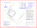
Land Survey Plat (LSP)
This is the plat (drawing) and results of the Monumented Land Survey. This plat represents how and why the surveyor made his/her decisions concerning the placement of the property markers (monuments). The plat also serves as the certification to the client.
By definition: CRS 38-51-102(12)
"Land survey plat" means a plat which shows the information developed by a monumented land survey and includes all information required by section 38-51-106.